EnVision
Challenges in Traditional Reality Capture
Reality capture often involves multi-stages processes, especially when a variety of captures devices are used. Traditionally, tools like LiDAR have been dedicated to capturing interior scenes, while drones have been used for exteriors. However, merging the data from these diverse tools into a unified model of a construction site has been a major roadblock for creating a comprehensive and complete reality capture. This often results in users defaulting to “Google Street View” type of representation created by typical 360 cameras. This limited perspective not only lacks the depth of a 3D structure but also prevents subsequent analysis, making tasks such as progress tracking or compliance checking against BIMs exceptionally challenging.
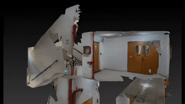
Introducing EnVision
Here’s where EnVision brings a paradigm shift. Not just another processing tool, but a comprehensive reality capture solution, EnVision is crafted to accommodate reality capture data from an array of sources. It is data-agostnic, meaning you can upload data whether it comes from drone feeds or LiDAR sensors, videos shot by 360 cameras, or even mobile devices. EnVision’s strength lies in its adaptability and integration capabilities. It merges both interior and exterior data sets to present a cohesive reality model, each entry timestamped to its specific capture date.
The 4D Reality Capture & Integration
EnVision is a core capability of VisionBuilder. Once reality capture data is processed and assimilated by EnVision, it is instantaneously available in VisionBuilder, forming the platform’s basemap. Here, users can indulge in interactive viewing or dive deep into advanced analysis, ensuring that the real-world construction aligns seamlessly with the envisioned design. With an intuitive time slider, stakeholders can also track and analyze construction progress over time, creating a bridge between initial plans and ongoing development. This holistic record will also become a reliable source of evidence for resolving complicated construction claims at the later stages of a project, significantly improving the transparency of project progress.